A Walk on Rhossili Down
In an ideal world I would prepare for a walk by researching it beforehand so I have an idea of what to look out for. However, this was a bit of a spur-of-the-moment decision and, as such, all I had to go on was the OS Map. Though that is definitely not to be sniffed at as a top-notch resource….
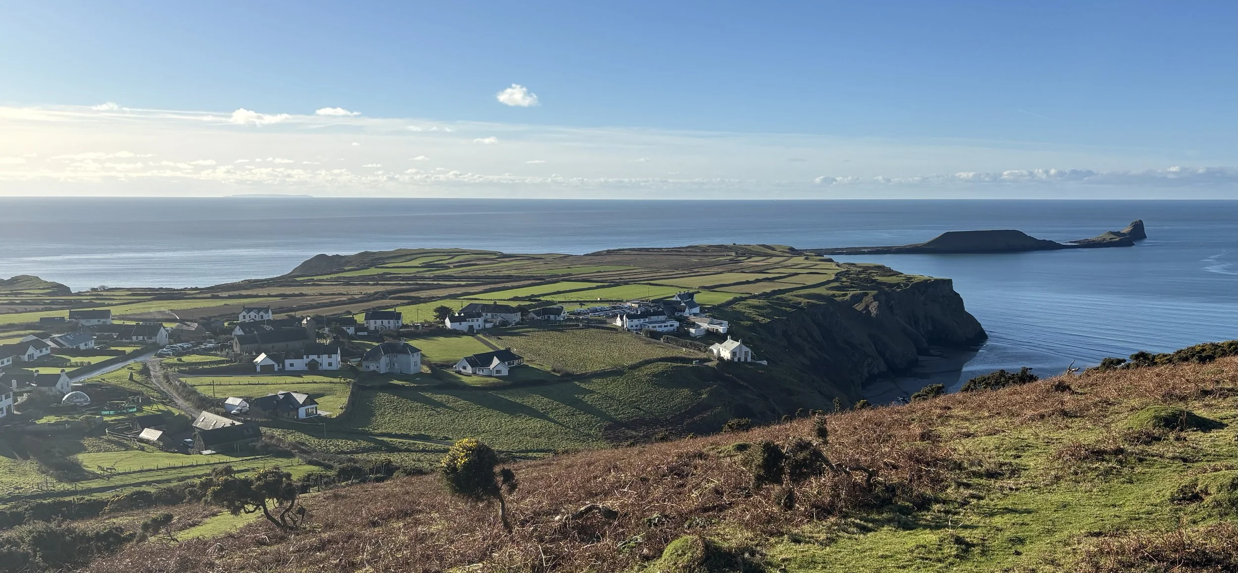
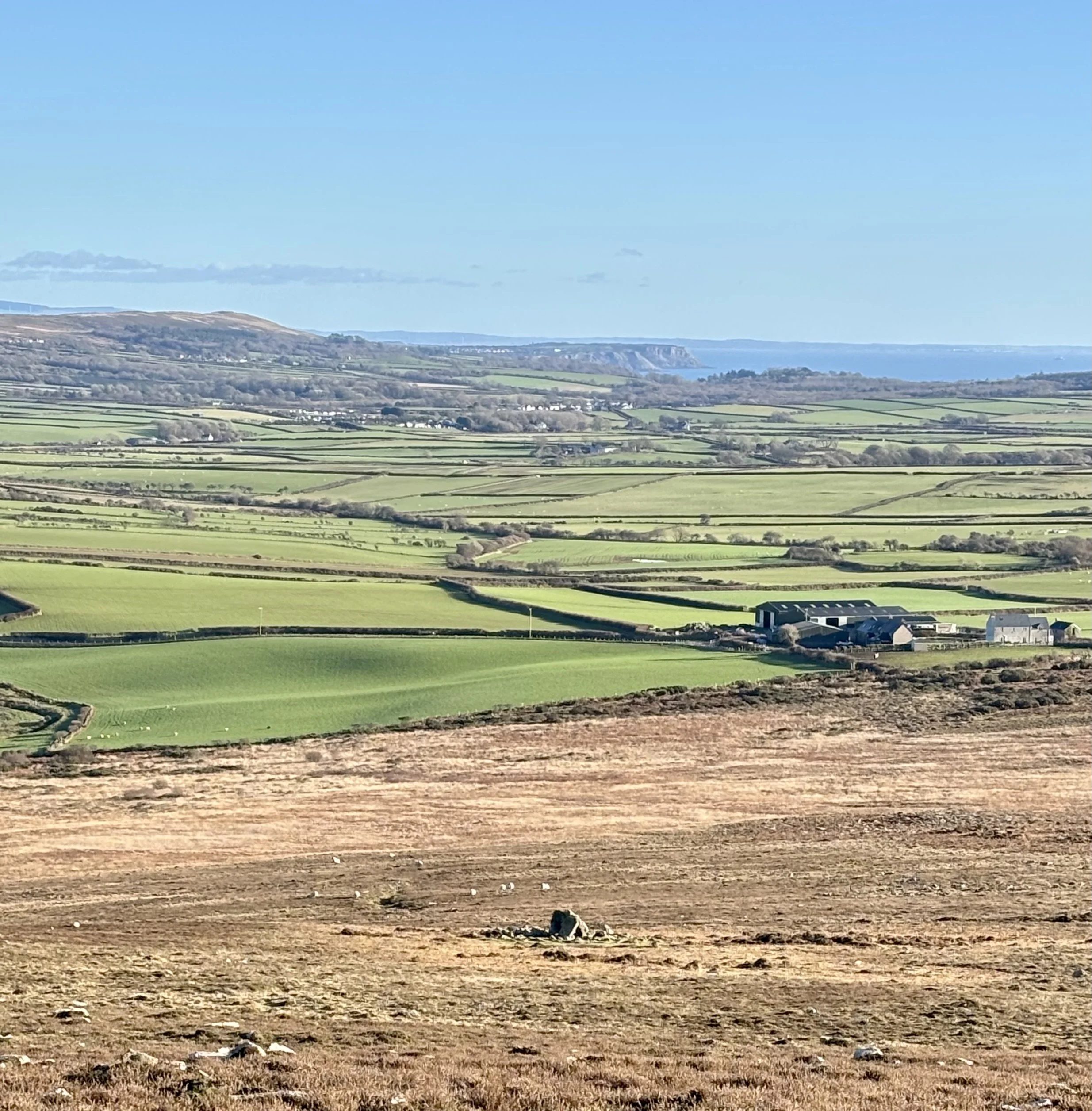
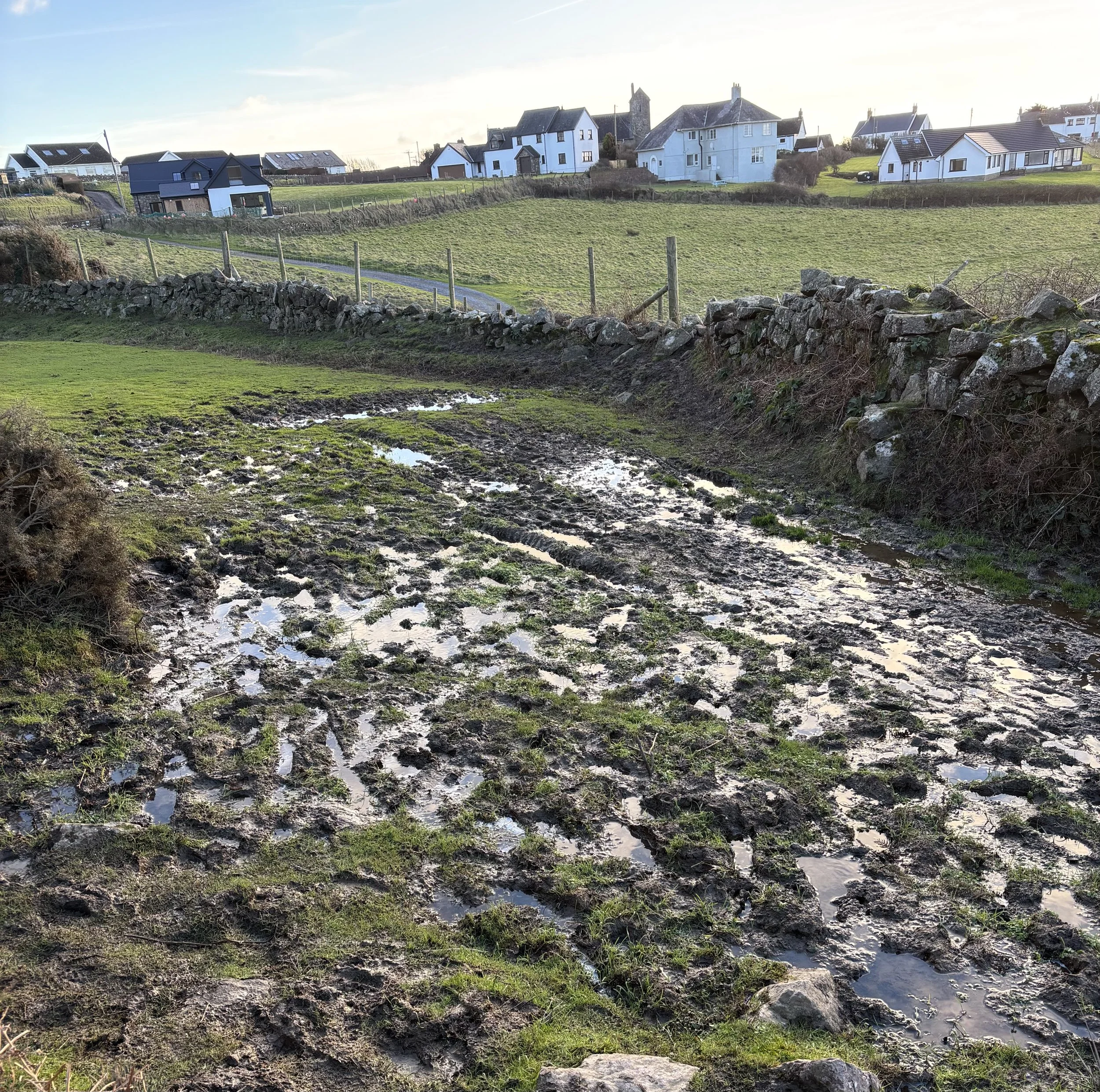
I was looking for walks close to the camp site and this appeared as a no-brainer: a steep climb up on to a ridge, lovely ridge walk with some of the italic writing I love to see on the top, finishing with a beach walk. Also it was around 5 miles which I thought would nicely fit the amount of time I had. I later discovered that the whole walk is described on the NT website here. The photo below is taken from just beyond the car park, looking back to Rhossili Down and the beach. It’s always good to see the whole walk before you start.
Rhossili Down and Beach, Gower
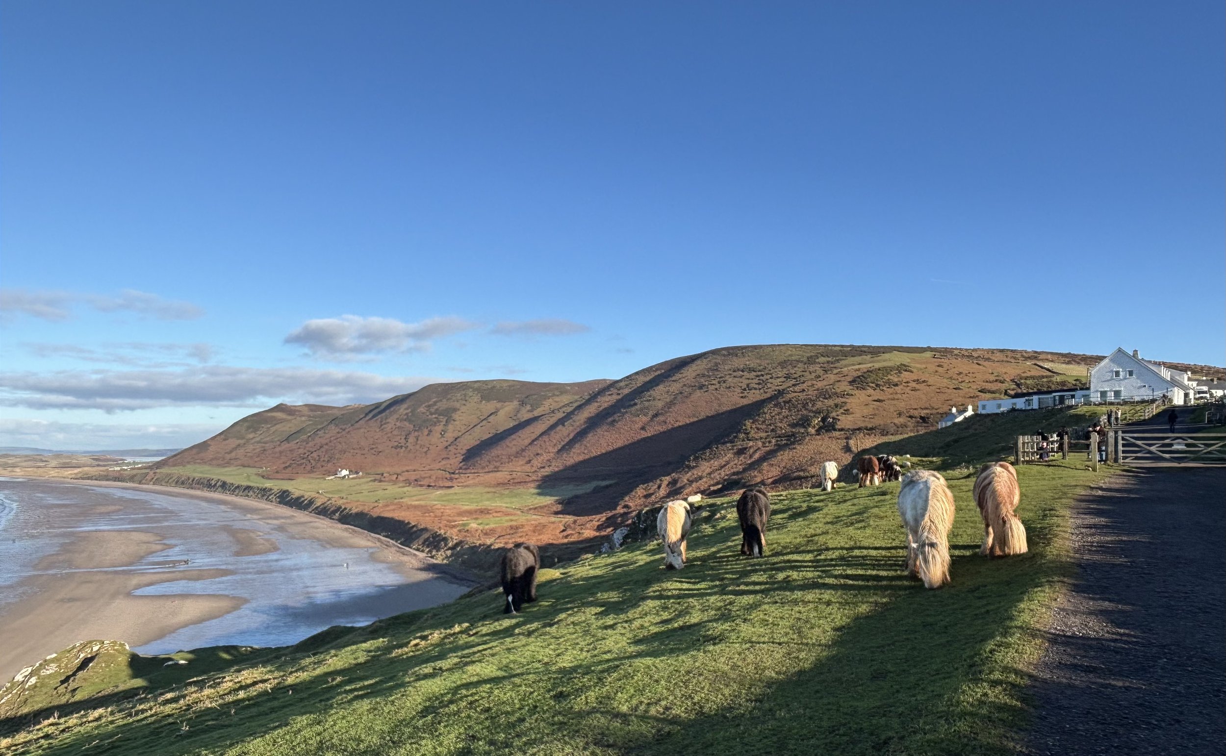
I parked in the National Trust car park (although you could also park at the church for £3) and began the ascent. It appeared steep but someone phoned me quite near the bottom and by the time I had finished the call I was at the top without really noticing. Somehow I had also managed to stop and turn around to look at the view and take a couple of pictures.
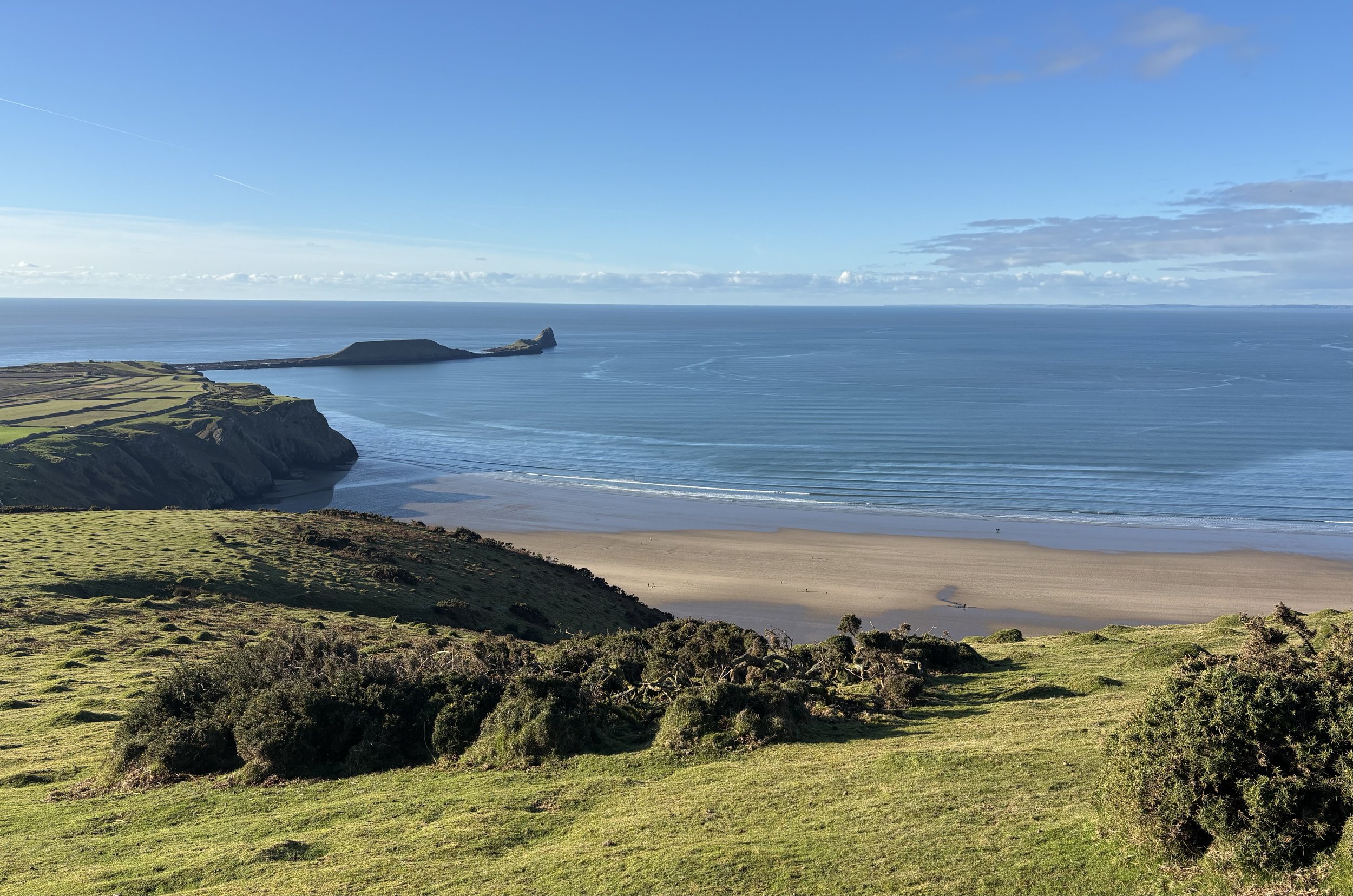
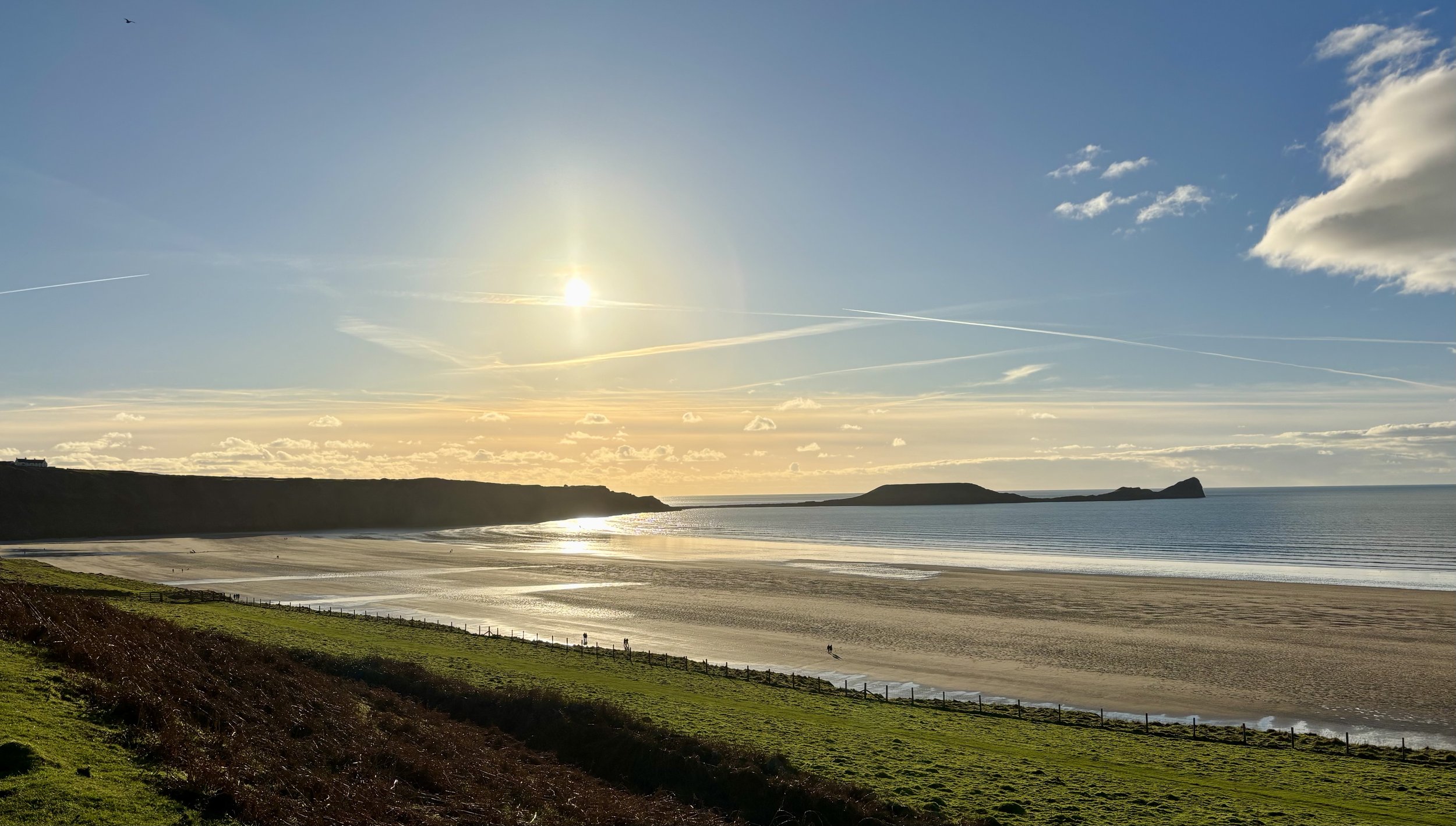
Looking back over Worms Head sticking out into the sea
During the walk I noticed something and wasn’t sure what it was so did some research at home. That was when I found out that there are all sorts of interesting things in this area that I hadn’t noticed at all!
Like the medieval strip field system behind the village of Rhossili. There is a good view of it as you walk up onto Rhossili Down and you can just about make it out in this photo below. This was a style of farming which used to be everywhere; now this is one of only a few remaining examples as most areas were enclosed in later centuries. How it worked was that each family had several strips of land, each around 200m long and, in this case, they were 15-70m wide. They might have several strips - but not together. The idea was that one person wouldn’t have all the best quality land while someone else had to make do with the marginal land of lesser quality. In between are one metre wide strips of raised earth or drystone walls which could be walked on like a path.
‘The Vile’ - strip farming fields behind Rhossili village
As the path is so steep it isn’t long before you arrive at The Beacon, the bit of land on which the OS trig point makes a focal point. Whenever you reach a trig point it is absolutely obligatory to stop and admire the view. And congratulate yourself for reaching the top. Although in reality, it wasn’t much effort. But the views were stupendous. It was a stunning day with a clear blue sky and a low tide showcasing the miles of beach stretching across the bay. The Beacon is 193m and is the highest point in Gower. I later found out that the trig point sits on top of a Bronze Age burial mound. To be honest, it wasn’t obvious - but it’s a shame I missed noticing it.
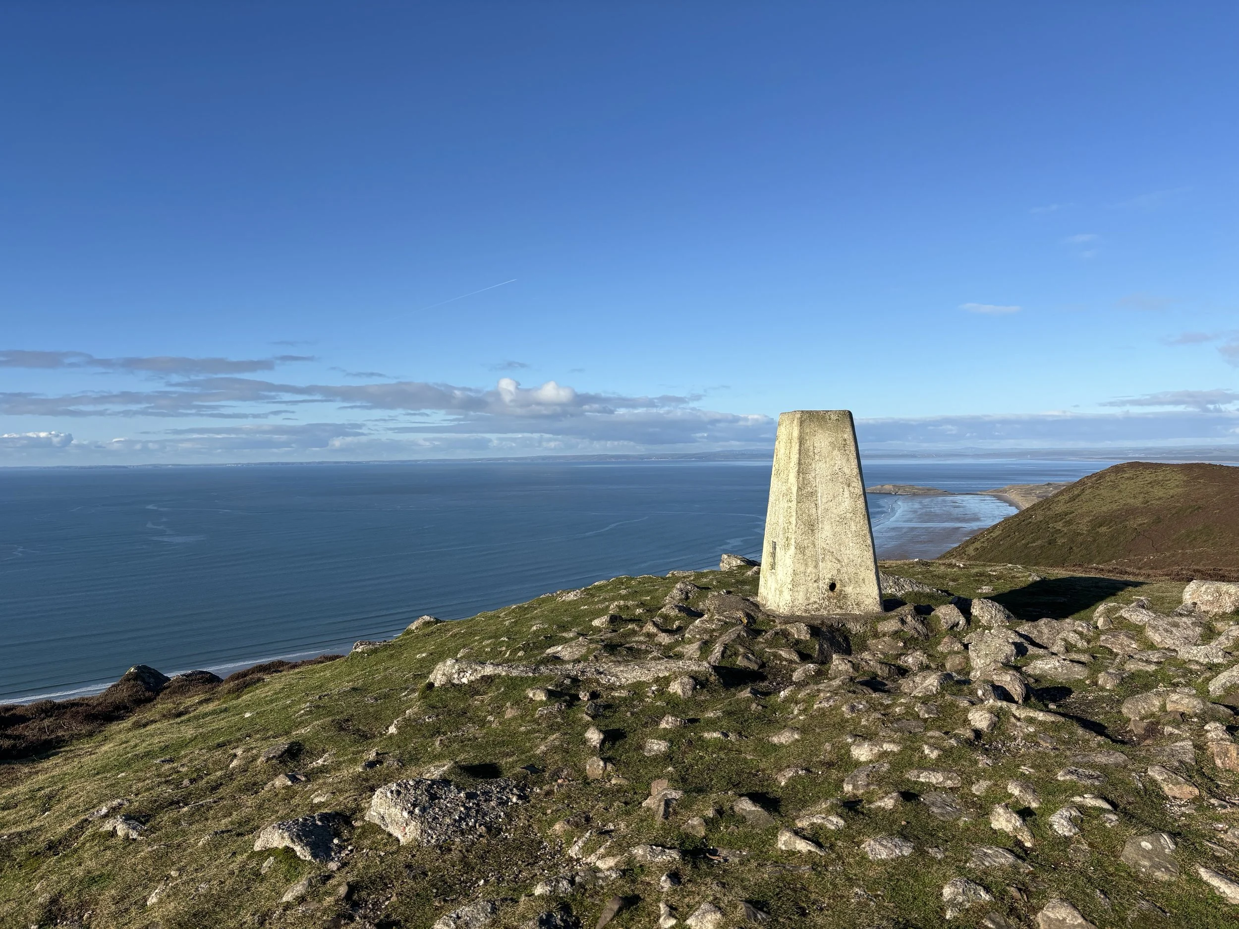
Trig point on top of Rhossili Down, Gower
The path was good and there are a series of cairns marked on the map right across the spine of the hill, next to the path. Well, I found a few modest piles of stones but nothing that obvious. What I had my sights set on finding was the Burial Chambers of Sweyne’s Howse. There are apparently two of them near the path. Well I just couldn’t find them at all. I looked down the hill and saw what was definitely a burial chamber so perhaps that was it - but I wasn’t walking all the way down just to see it and then come back up. So this photo will have to do. If you want to see what it looks like close up, have a look at this website.
I was enjoying the striding out style of walking you can achieve when you have done all the climbing and are now walking along a broad ridge, lapping up the panoramic views in every direction. This short video was taken from the trig point.
Before long I reached a rocky knoll on the left and headed up to get what would surely give me the best view over Worms Head and the beach. I wasn’t disappointed as you can see below. But what I hadn’t expected was the remains of a brick building and, looking back the way I had come, a long concrete platform. I didn’t go down to have a better look, assuming that I would be able to find out what it was when I got home. Turns out that it was a radar station, opened in 1942 and serving as a Coastal Defence Station to look out for ships and aircraft. It was only in operation for three years, during which time it had become part of the Chain Home Radar System. As its purpose changed from seeking ships to low-flying aircraft, so the personnel also changed from the Army to the RAF. They were based here in huts which provided both living and working accommodation. The Station was part of a network guarding the Bristol Channel on both the English and Welsh sides. This one reported to Swansea which is also where the manufacturers came from. It isn’t clear when demolition took place but they called it ‘Operation Eyesore’! Clearly they felt that the concrete buildings were totally out of character with the beauty of the surroundings. The base has been left and is cared for by the NT as part of the history of the area. When conservation areas were first proposed in England and Wales as part of the 1947 Hobhouse Report, 11 were wholly in Wales The first of these to be designated was Gower Area of Outstanding Natural Beauty in 1956. It was also the first in the UK. In 2023 all AONBs were renamed ‘National Landscapes’. It isn’t hard at all to see why Gower got this designation!
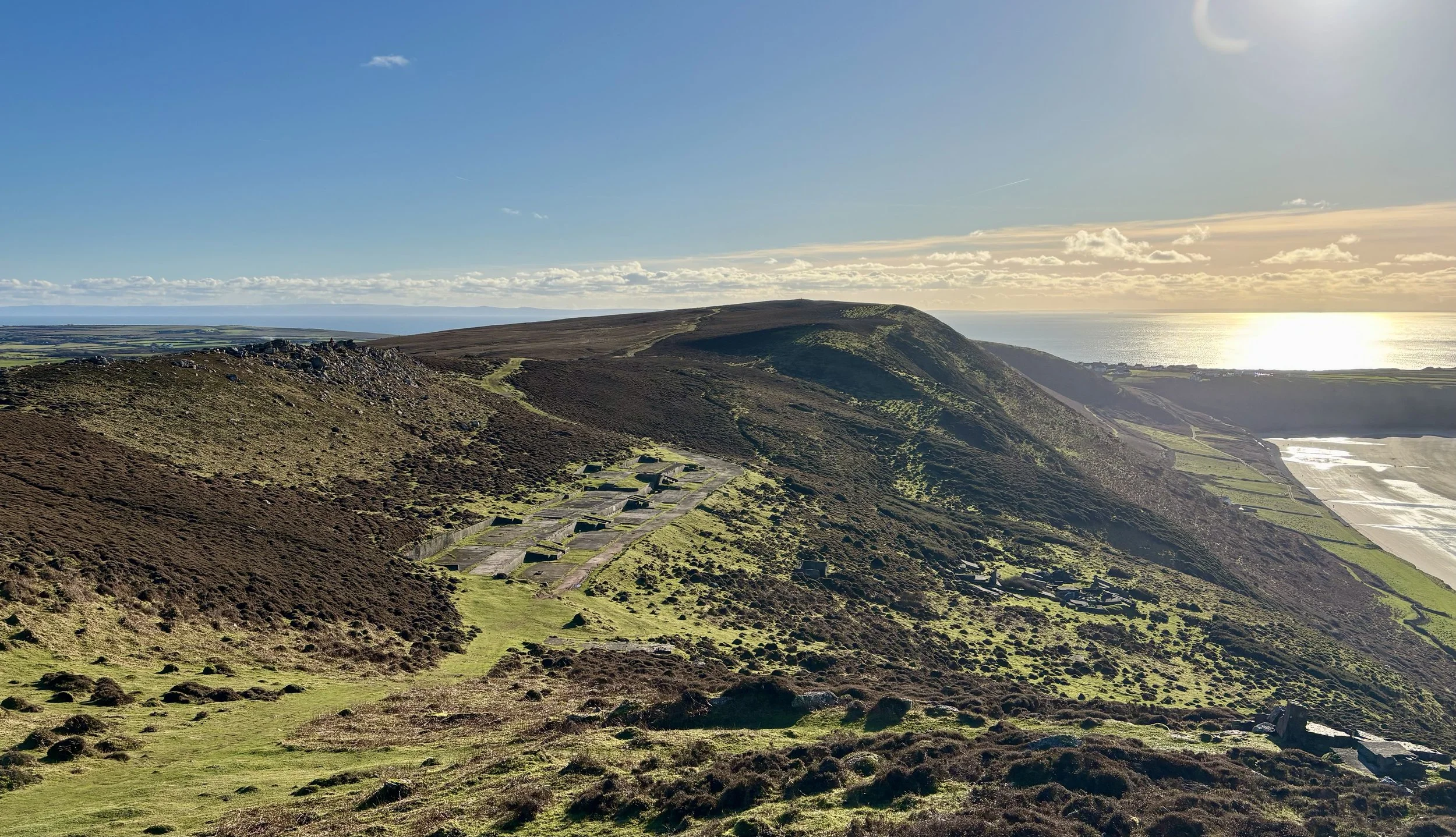
Remains of the radar station
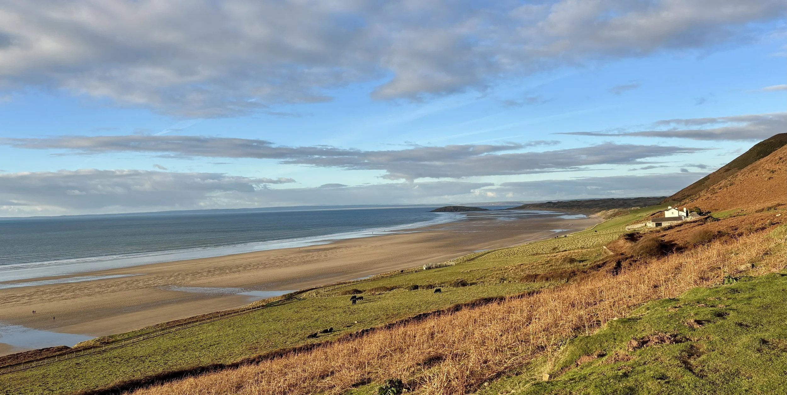
More striding out - this really was a super walk! And then I reached the point where I had to make a decision about which way to descend from the ridge. Looking at the contours, the direction route was extremely steep so I decided to take the longer but slightly less steep to the right. Although it was still a bridle way, it was clearly less used and, without a map it would have been quite hard to find the path at times. On reaching the bottom of the hill I turned left on to a lovely grassy path and set off. I intended to go down on to the beach but I was so busy looking at the caravan park and thinking other things that I completely forgot and missed the path. By the time I had checked the map and realised I’d missed it I was quite a way on the Wales Coastal Path. Oh well - let’s just carry on this path instead. BIG mistake! You might think that a National Trail would be in good condition all the time - but that just doesn’t apply in winter. I haven’t seen so much mud since the last time I walked in the Cotswolds in winter. I definitely should have turned back and gone down on to the beach. In summer I’m sure it’s a great path….
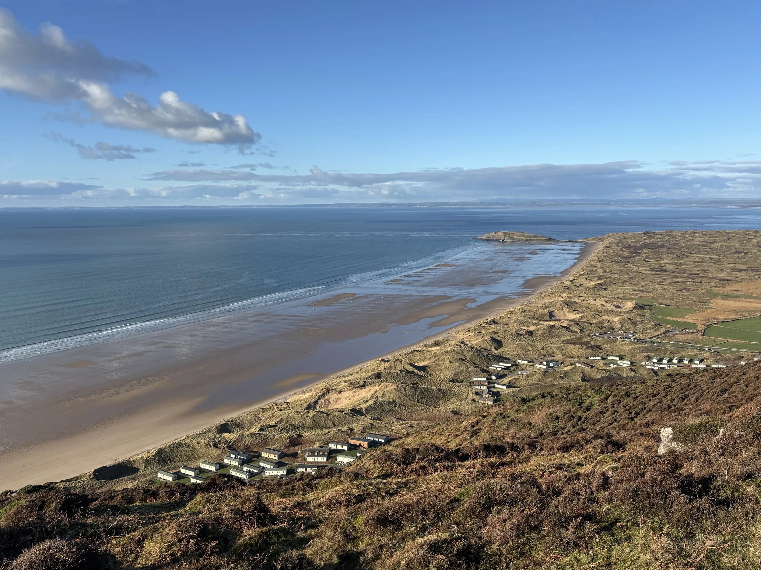
I intended to find the path through the caravan site!
Anyway, the advantage was I still had great views and at least I wouldn’t have the steep climb up steps at the end of the walk (I would happily have swapped that for the mud….)
About half way along I passed a pretty white cottage, now run as a holiday home by NT. I had been looking forward to reaching it, thinking house = road. No. That was not the case. How they reach the cottage except on foot is a mystery… I later found out (this website again) that it was built as a Rectory in the 1850s by a rector who decided that the best place for his new house was in between the two parishes he managed. It just also happens to be in an idyllic spot with outstanding views! It may have been the site of the original church and village of Rhossili. The picture below is looking back at the cottage.
The Old Rectory at the Warren
Not long to go now….I was at the stage where all I could think about was a cup of tea, my flask long since having been drained. And then I met the muddiest patch of ground I have seen for a long time. I tried forcing my way through the gorse bushes to the side (ouch) but that just wasn’t going to happen - so there was nothing for it but to try and tiptoe/wade my way through. All I could think was - at least I’m almost at the end.
I really could have done without this….
And so it was, that even when I saw a shed just past this patch and wondered what it was, I didn’t bother to take a photo. Back at that same website, I discovered that it is called the Rocket House. A rather grand name for what is a shed the size of a single garage. It was built in 1878 to house all the equipment needed for signalling to ships in distress and used for the first time the following year. However, it wasn’t much use in 1887 when the Norwegian ship Helvetia ran aground here, disgorging her cargo of timber onto the sands of Rhossili Bay. Thankfully all the crew survived and the locals made good use of such a fortuitous landing. It isn’t so easy to see from the coast path but you might just be able to make it out in this photo.
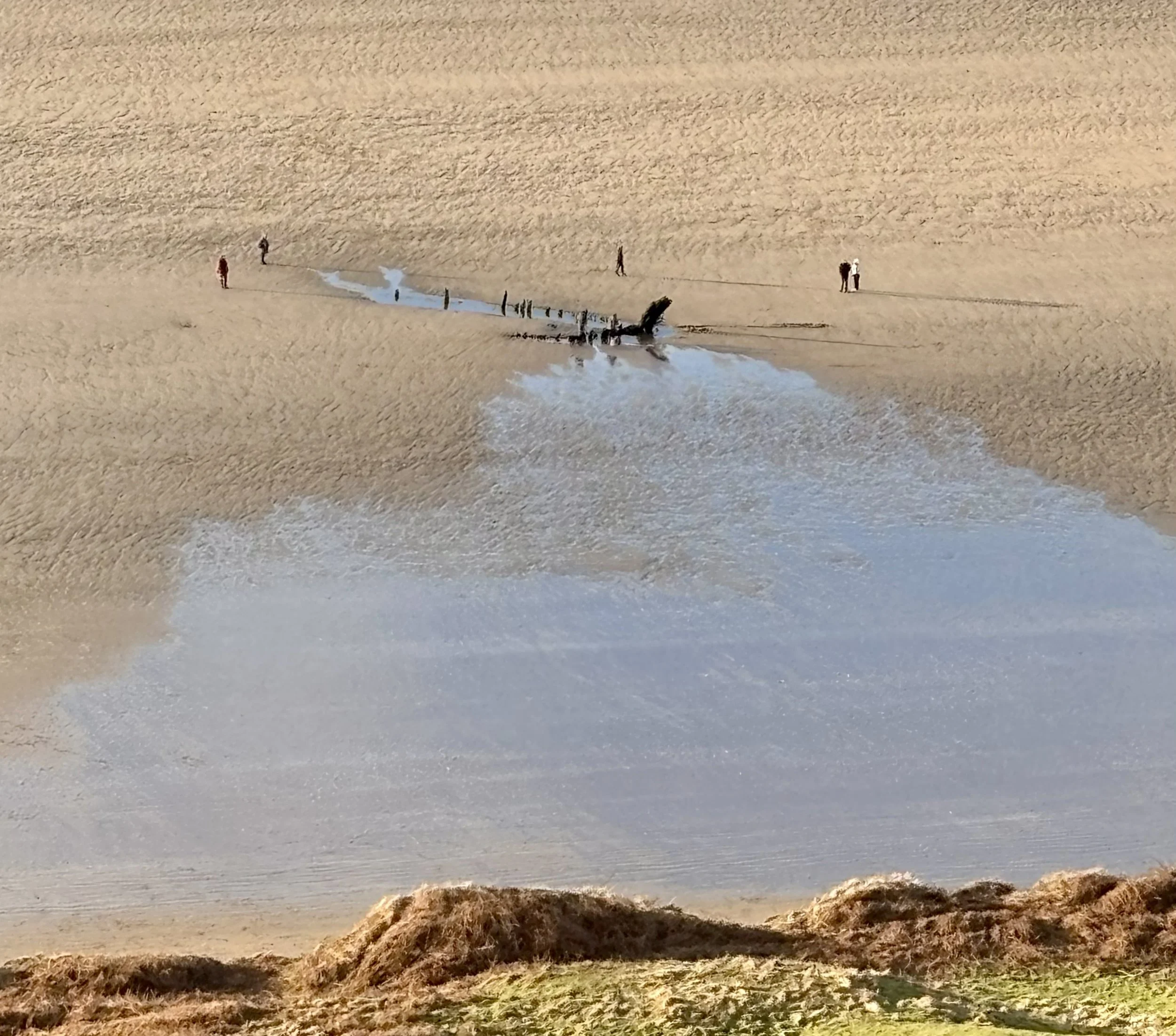
Wreck of the Helvetia, Rhossili Beach
By the time I reached the church it had closed so I had to just admire it from the outside. According to the information board, the first church was in the Warren, where the Rectory was built and may have been built in the mid 12th century on top of a Celtic site. During the 14th century storms brought sand onto the Warren, burying the church and the village moved to the top of the cliff. However this church of St Mary is also thought to date from the 12th century so it may have been in use at the same time.
The most unusual feature is the tower with a saddleback roof. It is possible that it was used as a refuge during periods of attack. Or the bells acted as a warning for passing ships… I couldn’t find any information about the unusual ‘chimney’ which maybe a very small dovecot on the side of the tower. A return visit is needed to see inside.
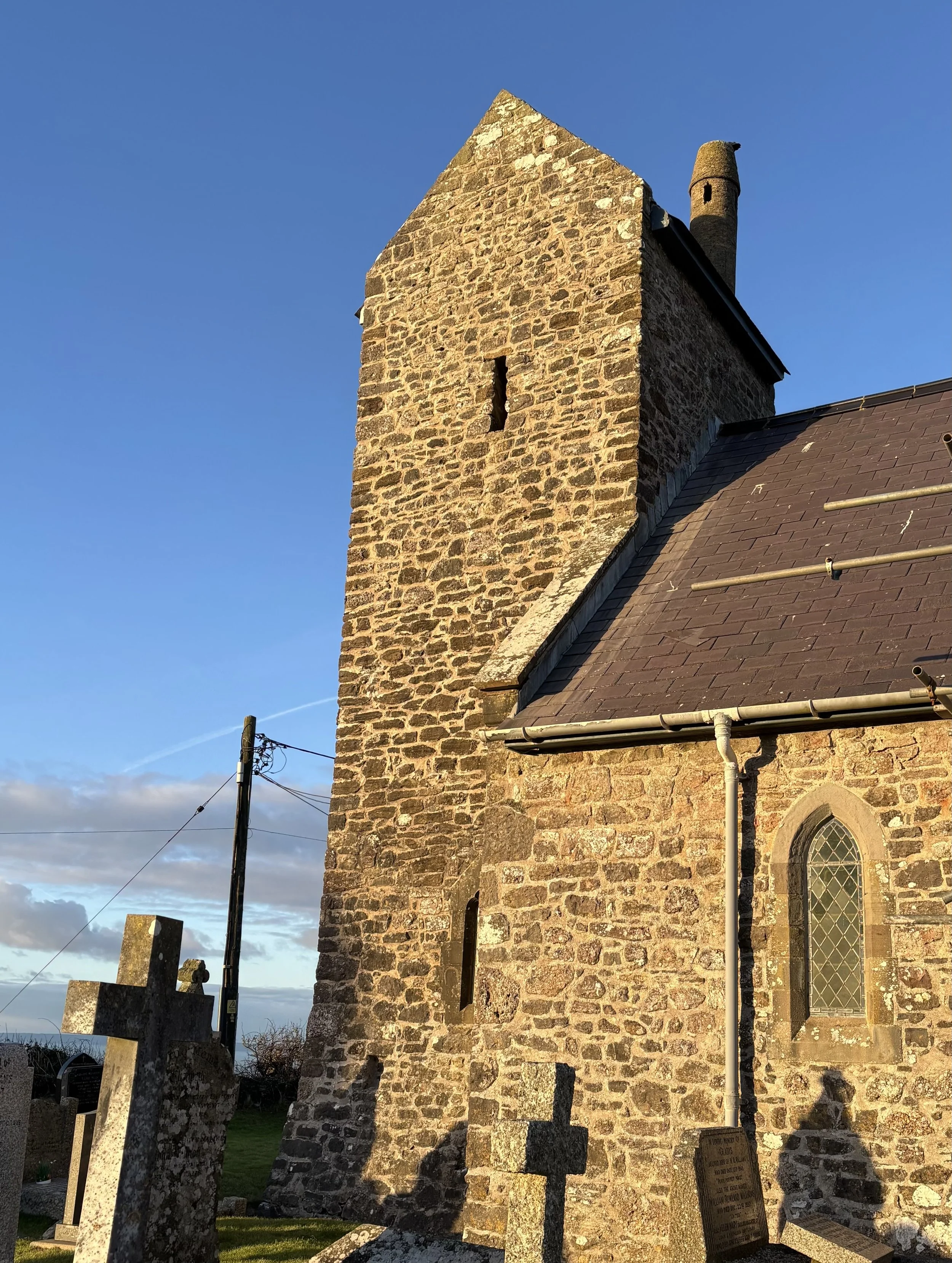
St Mary’s Church, Rhossili
This walk just about ticked all the boxes for me. Would have been even better if I’d chosen the beach rather than the coast path but you live and learn. Next time…
Except, there are so many fantastic places to walk in this area that it may be a while before I get to repeat it.
For more information, it’s always worth looking at Heneb - the Trust for Welsh Archaeology.